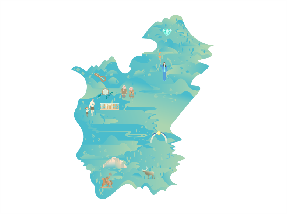
Geography. The region is located in the southeast of the Russian Federation. The area of the region is 361,908 km². It borders Yakutia in the north, the Khabarovsk Territory in the east, the Jewish Autonomous Region in the southeast, and the Trans-Baikal Territory in the west. The southwestern border of the Amur Region is a state border of the Russian Federation and borders the Peoples’ Republic of China. The relief of the region consists of mountains and plains.
Climate. The climate is transitional from severely continental in the northwest to monsoonal in the southeast.
Average temperature
- -27.6 … -32.8°С in January
- +20.7 … +17.6 °С in July
Population
Economy. The core industries are mining (gold and coal), forest and wood-processing industries, mechanical engineering, and metalworking.
Logistics. The region has a well-developed transport system (service to Moscow is provided on a daily basis by different modes of transport).
- The region is crossed by the federal highways Р-297 Amur and 360 Lena
- Four big railway lines connect the region with the central regions of Russia and the region's population centers together: the Trans-Siberian Railway, the Baikal-Amur Mainline, the Amur-Yakutsk Mainline, and the Ulak — Elga railway line. There is the Blagoveshchensk railway station.
- Blagoveshchensk Airport operates flights inside the country.
Tourist attractions
- The Vostochny Cosmodrome built as a substitute for Baikonur, leased from Kazakhstan, is located not far from Tsiolkovsky town. The first successful launch took place in 2016. Two years later, the tourist attraction program was launched. Groups are supposed to be taken to the viewing platforms during a rocket launch.
- The Kundur dinosaur locality was explored in the middle of the 20th century when an almost complete skeleton of a plant-eating dinosaur with a very long neck was discovered. Here, 65 million years ago, there was a route from Europe to Asia and vice versa, along which dinosaurs could migrate.
- The burning mountains are located in the Shimanovsky District, on the bank of Amur. This phenomenon is explained by coal deposits that constantly smolder or burn underground. The mountains have been burning for more than 300 years already. Because of this, you can often see thick smoke bursting out or spurts of open flame.
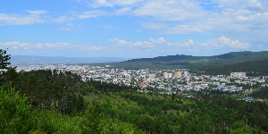
The capital is the city of Blagoveshchensk, located on the state border. It is only around 750 meters from China. The city was founded in 1856.
Population
4
recreational areas with fountains
There is the drama theater, the puppet theater, and the social and cultural center in the city.


